 WikiCatch
Fishing app for iPhone and iPad
Depth maps for 325,000+ fishing waters
WikiCatch shows you where the water is, how deep it is and when the fish feed: contours, per-species bite forecasts, AI fish ID and solunar times, worldwide and in 14 languages. Free to browse.
Free to browse. Pro is $4.99/month or $29.99/year, with a 7-day free trial on yearly.

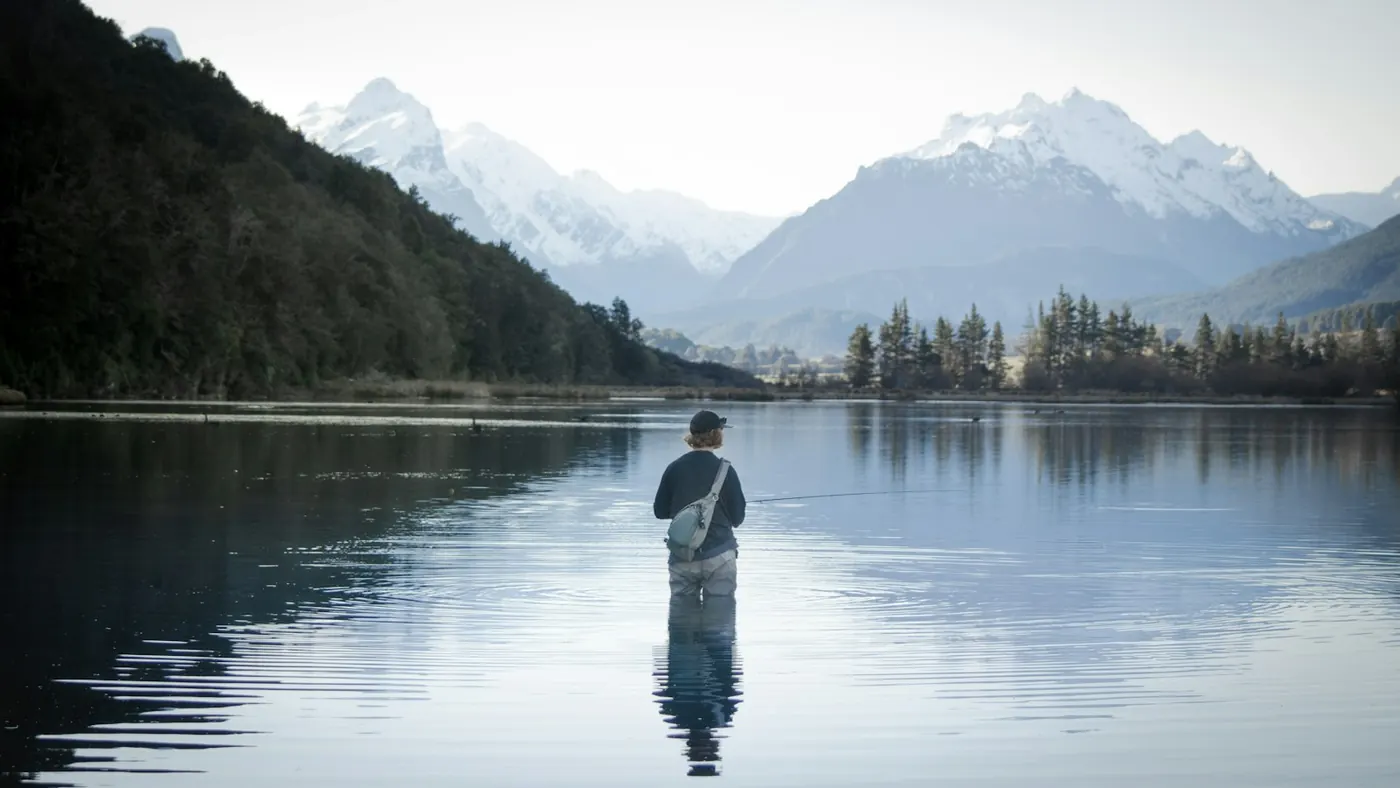
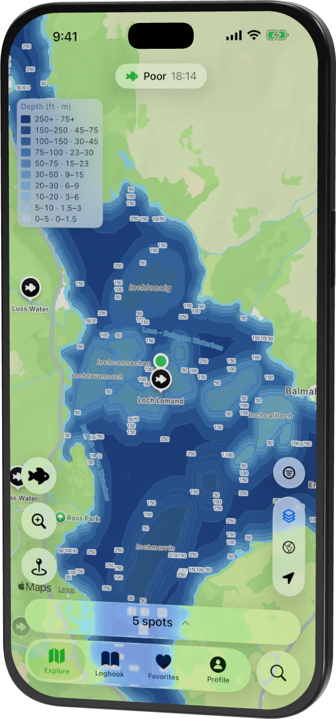
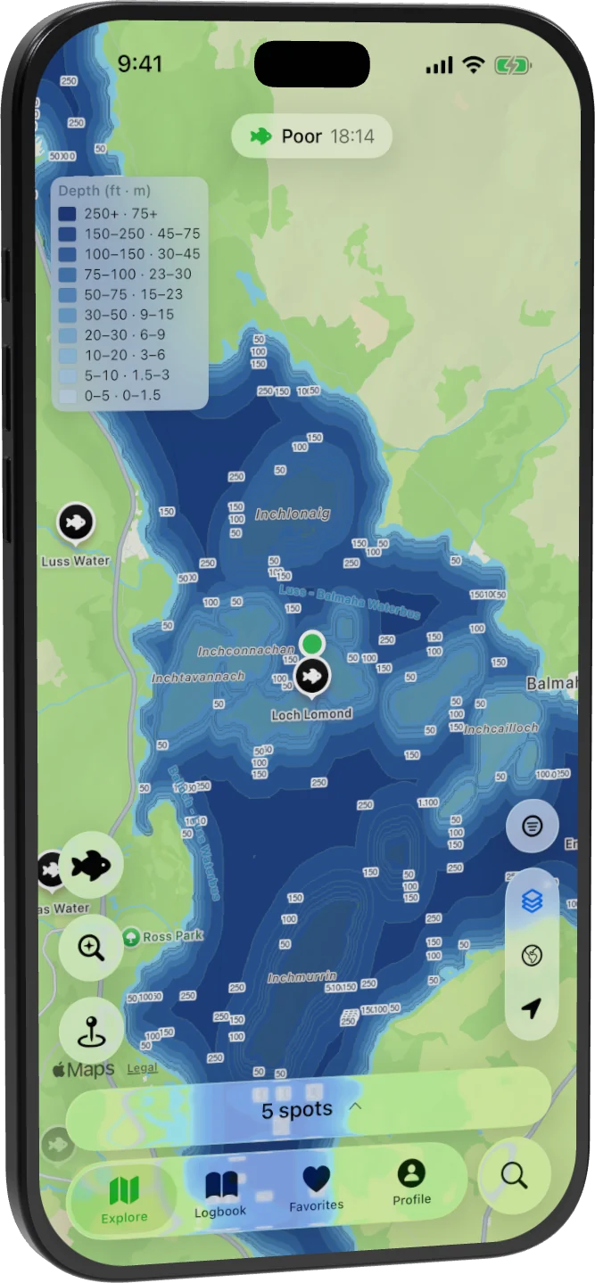
Loch Lomond’s depth contours in the app. Explore them on the map Photo: Alex Lange / Unsplash
- fishing waters
- 325k+
- species profiles
- 4,894
- countries
- 194
- app languages
- 14
Find your next water
Find water
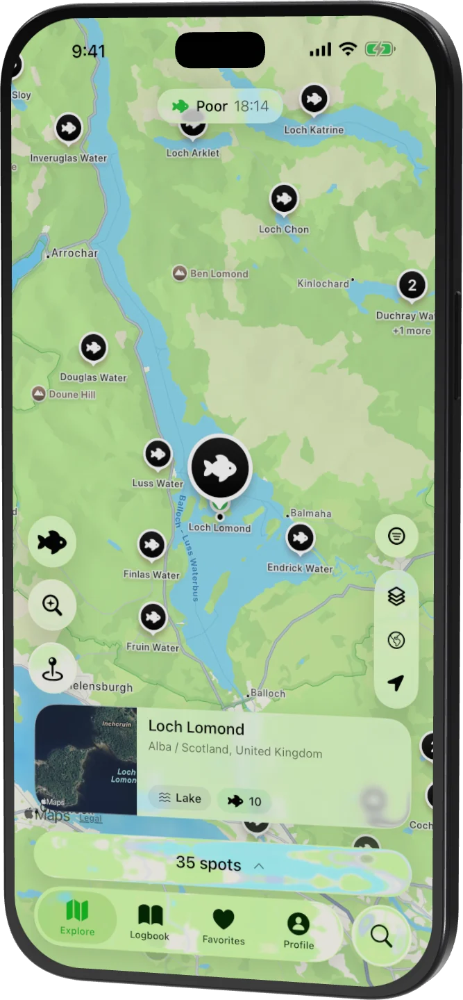
Every lake, river and stretch of coast, on one map
325,000+ fishing waters in 194 countries, filtered by water type and species, with the regulations link for the region.
Read the depth
See the drop-offs before you cast
Depth contours show shelves, holes and channels, so you can pick a swim from the bank or plan a drift before you launch.
Know when they bite
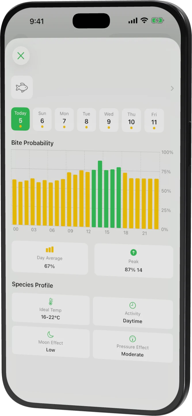
An hour-by-hour bite forecast, per species
Feeding probability scored from weather, pressure and solunar periods, with seven days of conditions to plan the trip. Part of WikiCatch Pro.
Also in the app
AI fish ID
Point the camera at a fish and get the species with a confidence score.
Baits and lures
Live baits, lures and technique notes for every species.
Catch log
Record what you caught, where and on what; keep spots private or share them.
Weather and solunar
Wind, pressure, temperature and moon phase at every spot; tide charts for coastal spots with Pro.
How it compares
Checked against each product's own pages, September 2026.
| WikiCatch | Fishbrain | onX Fish | |
|---|---|---|---|
| Coverage | Worldwide — 325,000+ waters | Worldwide | 13 US states |
| Depth contours | Included, worldwide | Pro — Garmin & C-Map | Included |
| Depth maps in a browser, no account | Yes | No | No |
| AI fish identification | Yes | Yes | — |
| Bite forecast by species | Yes | Yes | — |
| App languages | 14 | — | — |
| Price | $29.99 / year | Not published | $34.99 / year |
| Free trial | 7 days | 3 days | 7 days |
“—” means the product doesn't state it publicly, not that the feature is missing. Fishbrain doesn't publish a subscription price; onX Fish lists $34.99/year and the 13 US states it covers. Prices are US App Store and change by region.
Free to browse. Pro when you fish.
US prices; your App Store shows local pricing.
Free
No account needed to browse
- The web map and spot pages, with depth contours
- Species guides with baits and lures
- Today's weather and solunar times
- Catch log (free account)
WikiCatch Pro
$4.99/month or $29.99/year, with a 7-day free trial on yearly
- Full depth contour maps in the app
- 7-day hourly forecast for every spot
- 7-day bite prediction per species
- Full tide charts for coastal fishing
- Offline maps for trips without signal

Popular species
All 4,894 species →
Largemouth bass
Micropterus nigricans
63,952 spots

Smallmouth bass
Micropterus dolomieu
25,227 spots

Rainbow trout
Oncorhynchus mykiss
20,488 spots

Black crappie
Pomoxis nigromaculatus
20,385 spots

Common carp
Cyprinus carpio
13,114 spots

Pumpkinseed
Lepomis gibbosus
11,501 spots

Brook trout
Salvelinus fontinalis
10,933 spots

Walleye
Sander vitreus
9,762 spots
Fishing spots by country
All 194 countries →From the blog
All posts →4 min read
Streams are the most common fishing water in our data, and the hardest to find written up
Streams are 37.5% of the 325,549 spots in the WikiCatch dataset, more than any other water type. Just 0.75% are notable, the lowest rate we track.
5 min read
Poland, not Germany, has the best-documented fishery in our data
We ranked 37 countries by how much of their mapped fishing water is notable. Poland leads at 28%, 9x the global rate. Canada sits near the bottom at 0.7%.
4 min read
Rainbow trout: the closest thing to a global gamefish
Rainbow trout rank in the top 10 target species across 17 of 25 countries in the WikiCatch dataset, spanning five continents, more than bass or pike. Here's the breakdown.
Frequently asked questions
Is WikiCatch free?
Yes, to download and to browse. On this website the map, spot pages, depth contours and species guides are free with no account. In the app, today’s weather and solunar times and the catch log are free; WikiCatch Pro adds the full depth contour maps, 7-day hourly forecasts, species bite predictions, tide charts and offline maps for $4.99/month or $29.99/year, with a 7-day free trial on yearly (US prices).
How many fishing spots does WikiCatch have?
The website's data snapshot holds 325,000+ fishing waters in 194 countries: lakes, rivers, streams, ponds, reservoirs and coast. The app's live database is updated more often.
How does the AI fish identifier work?
Take a photo of your catch and WikiCatch identifies the species and shows how confident it is. It covers freshwater and saltwater fish.
Is WikiCatch available on Android?
WikiCatch is available on iPhone and iPad. There is no Android version yet; the map and spot pages on this website work in any browser.
What is solunar data and why does it matter?
Solunar theory predicts fish feeding activity from the positions of the sun and moon: major periods around the moon overhead and underfoot, minor periods around moonrise and moonset. Try the free best-time-to-fish calculator on this site, or see it per spot in the app.
Can I use WikiCatch without an account?
Yes. You can browse the map, view fishing spots, check weather and solunar data and explore fish species without an account. An account is only needed to log catches and follow other anglers.
Take the depth map fishing
Free on iPhone and iPad.
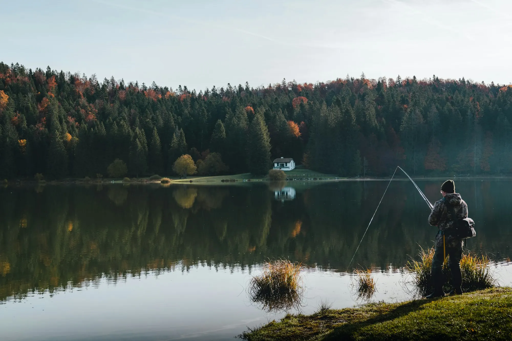
Photo: Léonard Cotte / Unsplash