 WikiCatch
Fishing Spots Map
Explore 325,000 fishing spots across lakes, rivers, and coastlines worldwide. Zoom in to see individual spots, click any marker to view species, ratings, and directions.
Depth maps, free to explore
Contours for lakes, rivers and coastline worldwide — the drop-offs, shelves and holes that decide where fish hold. Tap a water to open it on the map.
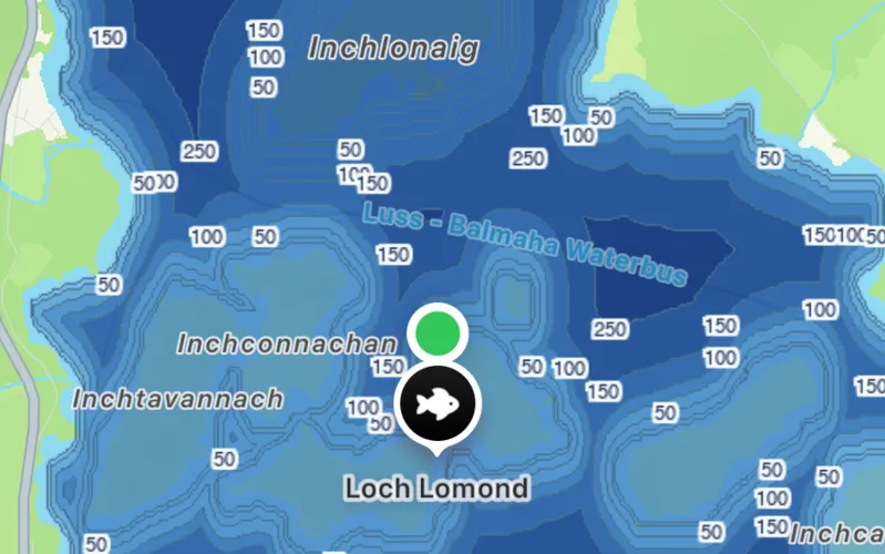
Loch Lomond, Scotland
Britain’s largest lake by area, dropping past 600 ft between the islands.
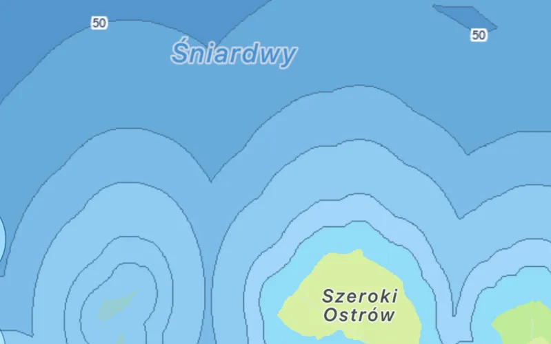
Śniardwy, Poland
The biggest of the Masurian lakes, shelving around Szeroki Ostrów.
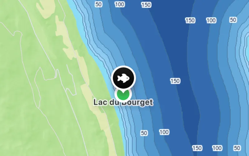
Lac du Bourget, France
France’s deepest natural lake — steep walls, fast drop-offs.
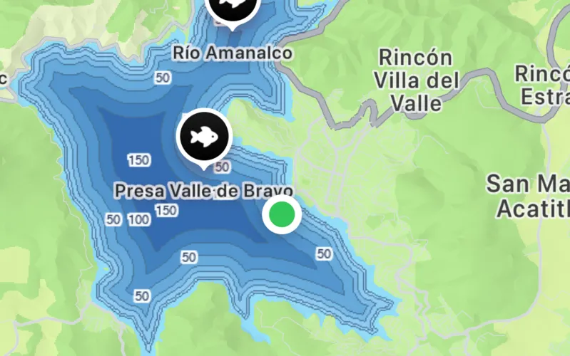
Valle de Bravo, Mexico
A flooded valley reservoir with the old river channel still visible.
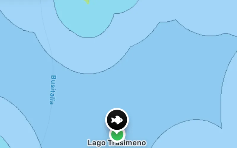
Lake Trasimeno, Italy
Broad and shallow, with the contours picking out its gentle basin.
Top-rated fishing spots
50 highly-reviewed spots from our community.
- ★ 5.0ReservatórioSão Paulo, Brazil
- HariAhal welaýaty, Afghanistan
- Amu DaryaQaraqalpaqstan Respublikası, Afghanistan
- Panjshir riverВилояти Хатлон, Afghanistan
- دره جوی Darah-e Jawayخوست ولايت, Afghanistan
- Peiwar Toiخیبر پختونخوا, Afghanistan
- Istia Toiخیبر پختونخوا, Afghanistan
- Manaروزگان ولايت, Afghanistan
- Zangزابل ولايت, Afghanistan
- Dungسرپل, Afghanistan
- Kushkغور, Afghanistan
- Sarband riverميدان وردگ ولايت, Afghanistan
- Waygalننگرهار ولايت, Afghanistan
- Shashgalنورستان ولایت, Afghanistan
- Hariهلمند ولايت, Afghanistan
- Jamهلمند ولايت, Afghanistan
- Kamati irrigation canalولایت بامیان, Afghanistan
- Zangولایت بامیان, Afghanistan
- Balkhولایت بامیان, Afghanistan
- Istmochولایت بدخشان, Afghanistan
- Daryā-ye Kizgitولایت بدخشان, Afghanistan
- Salangولایت بغلان, Afghanistan
- Kurundzhdaraولایت بغلان, Afghanistan
- Nalgak streamولایت بلخ, Afghanistan
- Balkhولایت بلخ, Afghanistan
- Jekولایت جوزجان / جوزجان ولایتی, Afghanistan
- Bandare Wasateولایت دایکندی, Afghanistan
- Chehelgazi Main Canalولایت سمنگان, Afghanistan
- Karies Pamiولایت غزنی, Afghanistan
- Arakhtولایت غزنی, Afghanistan
- Arabaqusai riverولایت غزنی, Afghanistan
- Arakhtولایت فاریاب / فاریاب ولایتی, Afghanistan
- Surkhولایت فاریاب / فاریاب ولایتی, Afghanistan
- Salangولایت فراه, Afghanistan
- Nawadakdaraولایت فراه, Afghanistan
- Rōd-e Shōrāwولایت فراه, Afghanistan
- Khushkābولایت كابل, Afghanistan
- Turkmanولایت هرات, Afghanistan
- Zangولایت هرات, Afghanistan
- Jarfولایت پروان, Afghanistan
- Deh Golولایت پروان, Afghanistan
- Shalozan Tangaiپکتيا ولايت, Afghanistan
- Kaparپکتيکا ولايت, Afghanistan
- Baladori canal path (0+000 - 10+135)کندهار ولايت, Afghanistan
- Turkmanکندوز ولایت, Afghanistan
- Västra KyrksundetLandskapet Åland, Aland Islands
- LillträsketLandskapet Åland, Aland Islands
- BorgsjöLandskapet Åland, Aland Islands
- LångträskLandskapet Åland, Aland Islands
- FladanLandskapet Åland, Aland Islands
Frequently asked questions
How many fishing spots does WikiCatch have?+
Over 325,000 fishing spots worldwide — lakes, rivers, reservoirs, and coastal saltwater spots — sourced from OpenStreetMap and enriched with community reviews, species info, and ratings.
How do I find fishing spots near me?+
Click the geolocation button on the map to center on your current location. Zoom in to see individual spots; click any marker to view species lists, ratings, and directions. For a deeper experience with offline maps, weather, and AI fish ID, install the WikiCatch iOS app.
Is WikiCatch free?+
The website is free. The iOS app is free to install; it includes free features like spot browsing and community ratings, plus Pro features like depth contour maps, AI fish ID, weather and solunar forecasts, and offline maps available via subscription.
Can I add a fishing spot?+
Yes — install the WikiCatch iOS app to add and rate fishing spots. Community contributions keep the map fresh.
What fish species are tracked?+
WikiCatch has a guide for 4,894 fish species with habitat info, max size, and best baits. Each spot shows which species have been reported there.
Get WikiCatch on iPhone
325,000+ fishing waters, depth maps, AI fish ID, weather & solunar. Free to browse.